Hi there! My name is Brooke and I am a senior Geography and Environmental Studies major at Middlebury College. I am passionate about using GIS, remote sensing techniques, and cartographic design to expand on studies of environmental justice, recreational access, climate change adaptation, and landcover change. On this page you will find my work from various courses, independent study, and research positions.
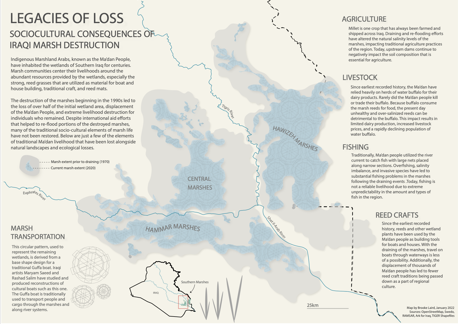
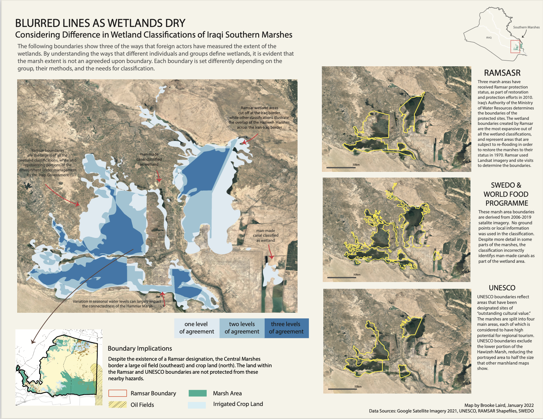
As part of my senior thesis I have created a series of maps to tell the story of wetland history, destruction, and conservation in the marshes of Iraq. You can view my visuals below. My entire thesis can be found here
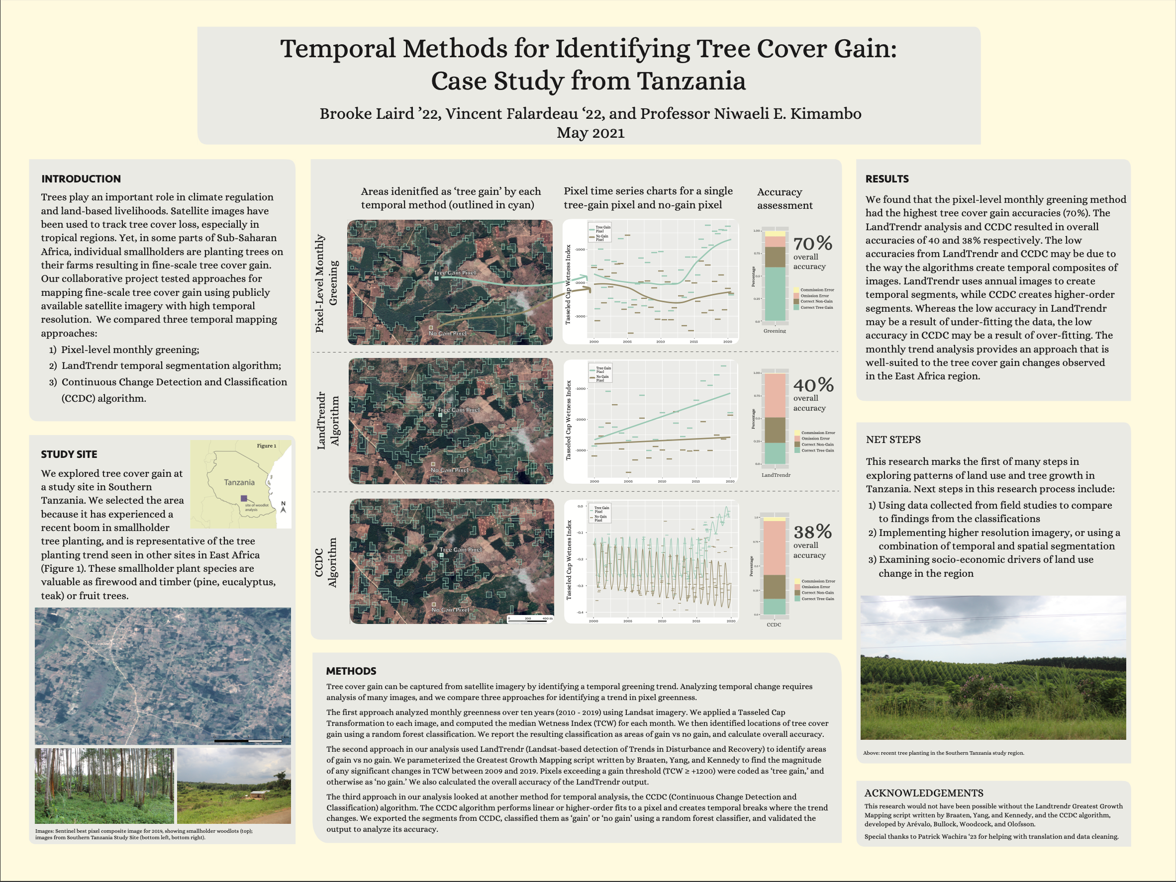
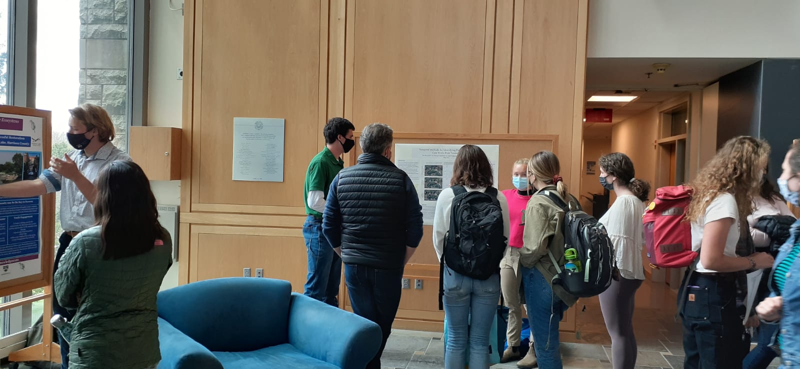
I have expanding my experience in remote sensing through Remote Sensing and Land Use, and Remote Sensing for the Geosciences. This past spring, I worked for Professor Niwaeli Kimambo (Middlebury College Geography Department) on developing methods for detecting woodlot growth in Tanzania, with a focus on visualizing the detected results. The poster presentation for this work can be found here, as well as a photo of our presentation at the Middlebury Spring Research Symposium.
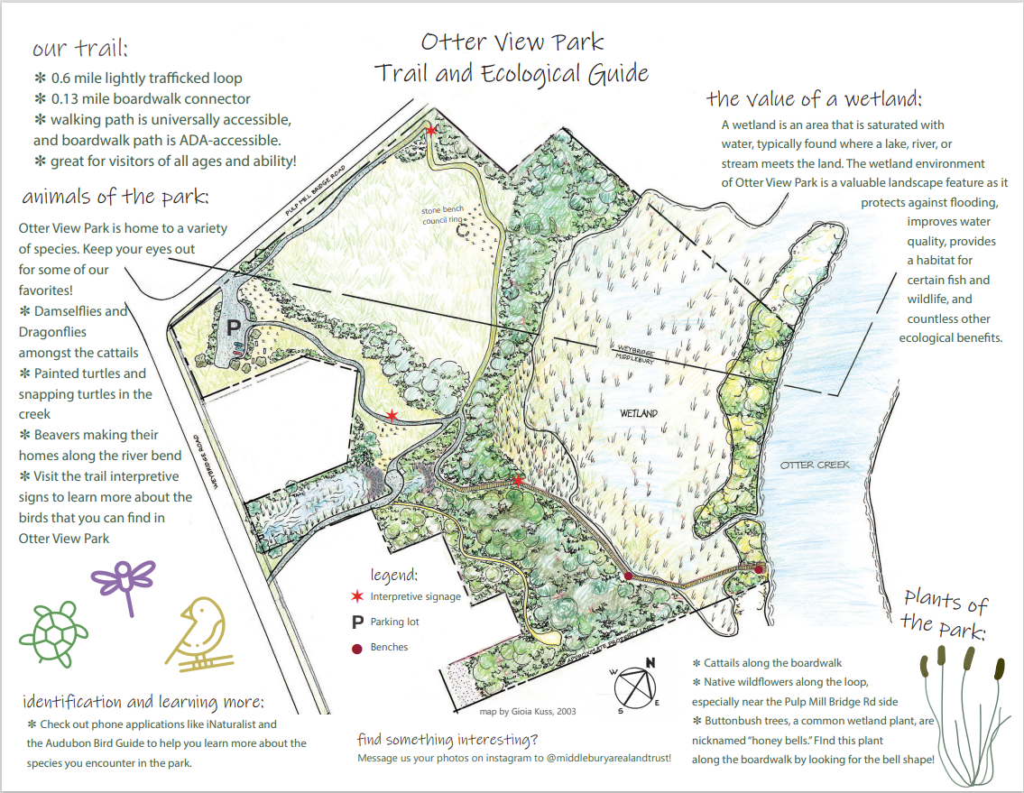
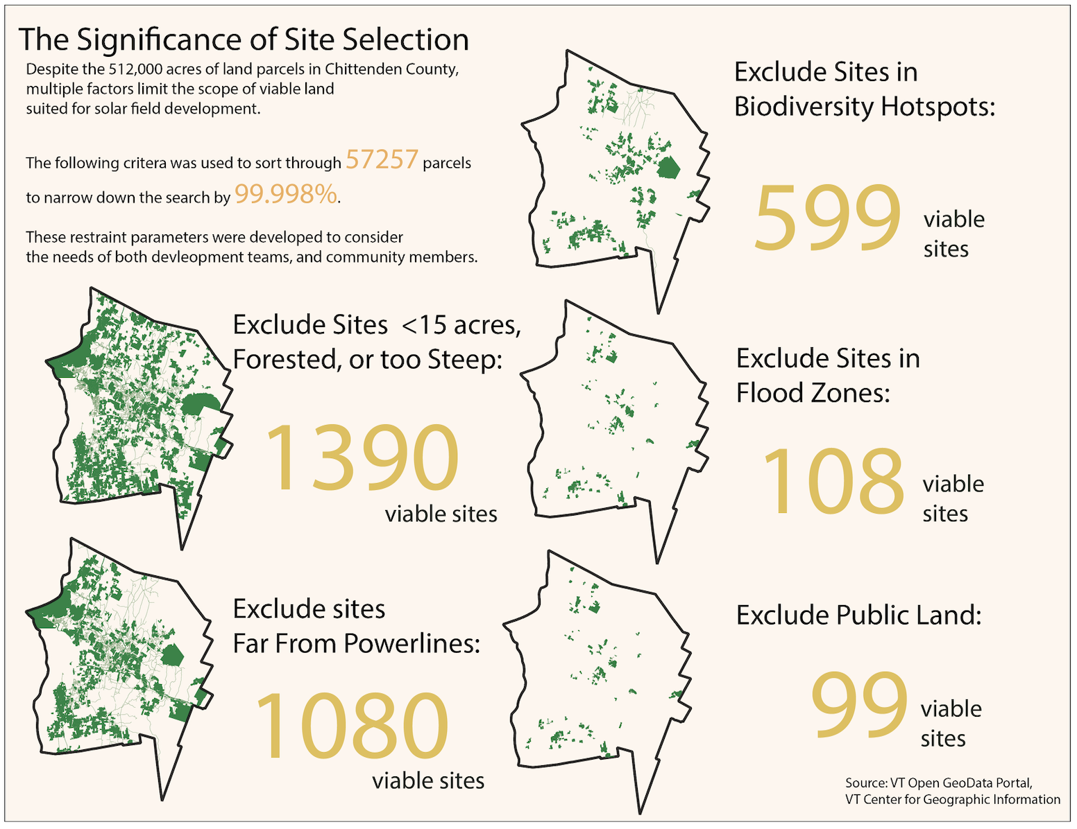
I have experience working with remote sensing tools and satalite imagery analysis in Google Earth Engine (javascript), QGIS, ArcGIS, and Python Scripting. This past fall I helped assist with the creation of a new conservation plan for the town of Middlebury, with a personal focus on trail accessability. Final results will be shared soon, but for now you can view the python scripts and documentation here
I have conducted an analysis of wetland restoration and development efforts in the Southern Iraqi Marshlands as a term paper for my senior seminar, Geographies of Climate Change and Adaptation. You can check out my final paper here! This work is currently being continued as part of my senior research on climate change cartography and environmental mapping.